Hiking with dogs
Niederhorn panoramic trail
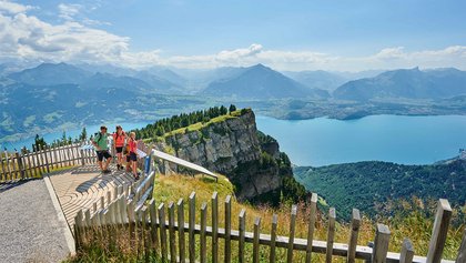
Take your four-legged friend along and enjoy the breathtaking panorama from the Niederhorn, with views onto Eiger, Mönch and Jungfrau. The route offers insight into a range of natural environments, from heath and moorlands through to rocky limestone formations.
Information
- The area around the Niederhorn is a nature reserve. Please be mindful of the wildlife and keep your dog on a lead.
- Also please note that the section after Burgfeldstand requires a head for heights and is secured with ropes.
- Parking: Car parks in Beatenberg/Waldegg – charges apply.
- Public transport: via Interlaken West to Beatenberg, then take the cable car to the Niederhorn.
Lakeside idyll by Lake Brienz
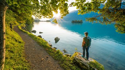
The hiking trail from Iseltwald to the Giessbach falls counts among Switzerland’s most beautiful lakeshore trails. Following the shoreline of the blue-green waters of Lake Brienz, the path leads through magical mountain forests and past idyllic barbecuing sites and bathing spots – perfect for a quick dip. A short climb then leads visitors to the thundering waterfalls of the Giessbach. For a leisurely return journey to Iseltwald, why not hop aboard a boat at the Giessbach stop.
Information
- The public car park is located on the road into Iseltwald.
- Public transport: By boat from Interlaken Ost to Iseltwald (timetable BLS lake cruises)
Lauterbrunnen – Stechelberg
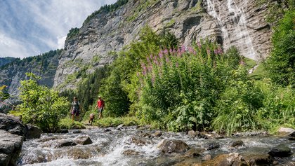
Enjoy this dog-friendly walk from Lauterbrunnen to Stechelberg and take in the picturesque scenery, surrounded by majestic waterfalls, lush meadows and impressive rock faces. The return journey to Lauterbrunnen can be made by bus or on foot via the same route.
Information
- There are parking spaces in the Lauterbrunnen car park. There is also a large car park next to the village church (charges apply).
- Public transport: Frequent connections by train and bus (sbb.ch)
Hasliberg panoramic trail
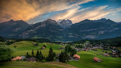
Follow this panoramic trail for a scenic and delightful hike from Hasliberg Reuti to the Brünig pass. The route starts out with a ride in the gondola lift from Meiringen to Hasliberg Reuti. From there the path meanders up and down and offers breathtaking views onto Lake Brienz and the surrounding mountains. The start and end sections of the hike are largely forested, crossing more open areas around the villages. At the swimming lake in Hohfluh your dog can go for a refreshing dip. You may encounter wildlife along the way, please be prepared.
Information
- There are car parks in Meiringen and by the lower terminus of the Meiringen–Hasliberg gondola lift.
- Public transport: The trains to Meiringen run every half hour (sbb.ch)
Photo trail
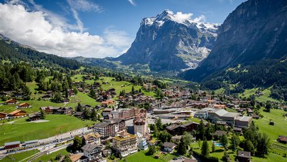
The Photo trail in is a picturesque circular hike for dog owners. Starting at Bahnhof Grindelwald, the route heads up the steep Kreuzweg, offering exceptional views of Eiger, Wetterhorn, Mettenberg and the Fiescherlücke. As you make your way through the village, there’s ample opportunity to take in the breathtaking views of Eiger, Kleine Scheidegg and Männlichen. At Truffersbrunnen you’ll be regaled with lovely views onto the idyllic Wärgistal with its fields, meadows and typically Swiss chalets. This dog-friendly walk includes plenty of places to stop off at and will be an unforgettable experience for you and your pet.
Information
- Parking is available at Eiger+, Sportzentrum and Terminal Parking.
- Public transport: Frequent connections by train and bus (sbb.ch)
Arvenseeli circular walk
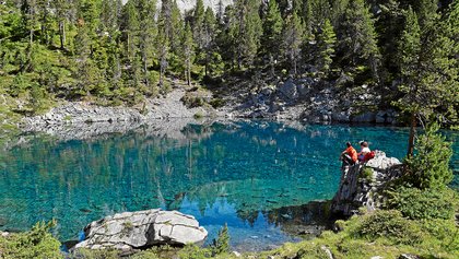
This hike to the three small but beautiful Arven lakes is ideal for an outing with your dog. From the end of May to mid-July, the lakes offer opportunity for a cooling dip. At the final lake there is also a barbecuing spot with benches and firewood, making it the perfect place to linger. Sunnbüel can be reached by cable car from Kandersteg.
Information
- Parking is available next to the lower terminus of the Sunnbüel cable car.
- Public transport: Accessible by bus and train, then with the Sunnbüel cable car (sbb.ch)
Elsigseelein circular walk
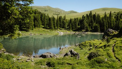
To reach the start of the hike, take the Elsigenalp cable car. The beautiful circular walk then takes you to the idyllic little Elsigsee. The mountain lake is the perfect place for you and your dog to relax and re-energise, and has a barbecuing spot with firewood. This walk is also suitable for families with small children in buggies, making it an ideal activity for a family day out with your furry friend.
Information
- Free parking is available at the lower terminus of the cable car and at Berggasthaus Höchst in Metsch.
- Public transport: By train and bus to Elsigbach (sbb.ch)
Hiking through the year – crocuses on Rämisgummen
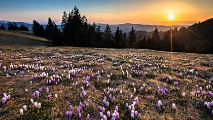
This trail starts at Bahnhof Trubschachen and leads to the beautiful crocus meadows on Rämisgummen. Bring your four-legged friend along and enjoy the picturesque scenery of the Emmental Alps. Particularly impressive is the carpet of blooms that appears on Rämisgummen shortly after the snow melts (end of March to mid-May, depending on the weather). The hike ends at the Schangnau Post bus stop.
Information
- Parking is available at Bahnhof Trubschachen and in Schangnau.
- Public transport: Take the train to Trubschachen (sbb.ch)
Amiet Hesse way
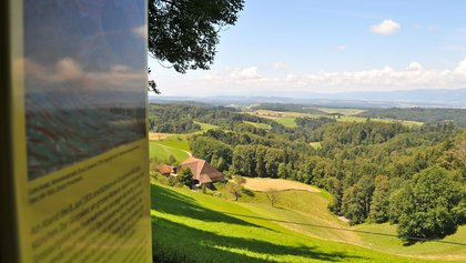
The Amiet Hesse way starts at Riedtwil bus station and offers two hiking options: A shorter 90-minute circular trail around Oschwand and the hamlet Spych, or a three to four hour route along the Mutzgraben valley to the waterfall. From there the trail takes you via Juchten and Rotenhaus back to Oschwand. Take in the delightful scenery and gain insight into the work of the two artists Cuno Amiet und Bruno Hesse. The dog-friendly route offers plenty of opportunities to stop off and explore with your dog.
Information
- There is a public car park near the Landi shop in Riedtwil, next to the Agrola petrol station.
- Public transport: Accessible by train and bus (sbb.ch)
Bantiger hill, the viewpoint close to the city
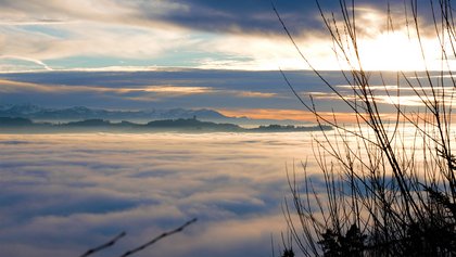
Much of this hike leads through the forest and past welcoming barbecuing spots. Before heading up to Geristein, we recommend making a short detour to the Geristein castle ruins. Continuing through the forest and along the edge of a clearing, the path then takes you to Bantiger hill. The observation terrace of the 196-metre radio and television tower on the Bantiger offers breathtaking views across the central plateau and Emmental, all the way to the Alps. The final stage of the hike is a steep descent towards Chatzestyg, followed by a relaxed walk back to the car park.
Information
- Please note that climbing the stairs of the radio and television tower may be difficult with a dog.
- Free parking is available at the start point by Cholgruebe.
- Public transport: By train and bus to Hub b. Krauchthal, Schulhaus, from here take the Laufenstrasse in the direction of Laufenbad (sbb.ch)
Up the Jolimont
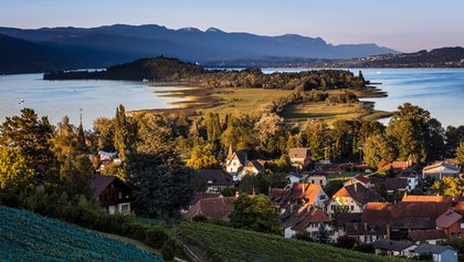
The hike up to Jolimont hill starts in Ins on Lake Biel and takes visitors through picturesque landscapes, the village of Tschugg and culminates on Jolimont peak. The summit offers views onto the small town of Erlach and St. Peter’s Island. There are multiple inns along the way where you can stop for a bite to eat. If you’d like to extend the hike, why not make a detour to St. Peter’s Island, or take a leisurely boat trip back to Biel/Bienne.
Information
- Please ensure you keep your dog on the lead on the specified sections of the walk and bring sufficient water along for your pet, as there are no natural water sources en route.
- Paid parking spaces are available at Ins train station
Public transport: Take the train to Ins, Bahnhof (sbb.ch)
Nods–Chasseral–Nods
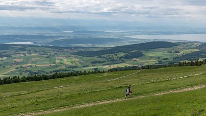
The hike up to the Chasseral peak starts in Nods and initially follows a cycle route for a short stretch. The path then leads through forests and pastures towards Hotel Chasseral. The peak offers fantastic views onto the lakes of Biel, Neuchâtel and Murten, and is part of a nature reserve. Please bear this in mind and keep your dog on the lead. After admiring the beautiful panorama, follow the signpost to La Neuveville for the route back.
Information
- There is a public car park in Nods.
- Public transport: By train and bus to Nods (sbb.ch)
Tips for hiking with dogs
| Tip 1Prior to departure, get information from the local tourism office concerning any equipment required for taking your dog on a specific hike. |
| Tip 2Check with the tourism office whether the hike leads through nature reserves, areas with livestock guardian dogs or cowherds with calves. Its also worth finding out whether parts of the route are on paths shared with mountain bikers (shared use trails). Dogs must be kept on leads on sections where any of the above applies. |
| Tip 3Take enough water with you. Streams may have dried up and you dont know whether you will encounter fountains along the route. On hikes, dogs should have access to water approx. every 45 mins. |
| Tip 4Essentially, dogs also have to learn how to cope with difficult terrain. It is therefore best to start out walking on straightforward terrain and to adapt the difficulty level to the fitness of your dog. |


